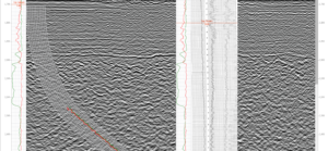
Raster Log and TIFF Rendering in the Cloud with GeoToolkit.JS
A common challenge that our users face is a need to render and display huge images like raster logs and GeoTIFF files. Interactions occur in the client’s server architecture, and while these images can be stored in the cloud or on a server, they are usually very large files, making it difficult to move from the server to the client. It is also time-consuming to read data from the cloud and unpack operations for TIFFs. When trying to open these files, the user may have to wait up to several minutes to start to receive data from the server. This can lead to a poor user experience because the client doesn't know if a server is working or if it's already halted the solution that we applied.

Integrating Powerful Map Capabilities into Your Subsurface Web Applications
Map-based search is an integral part of subsurface data visualization. In order to meet usability expectations, developers of subsurface applications in the cloud must add powerful map and map-based search functionalities. The GeoToolkit map widget simplifies the process, allowing users to get quick and clear insights using common web mapping services.

GeoToolkit 2020: Top New Features
GeoToolkit is a suite of 2D and 3D data visualization libraries that display well log, seismic, contour, schematics, BHA, maps, and more in JavaScript. Released earlier this year, GeoToolkit.JS 2020 comes with various new features and significant improvements. Highlights from the latest release include: improved ArcGIS support, faster load times, new tools, multilateral schematics, new gridding algorithms, and improved memory for volumetric rendering.

How to Add Overlay to Visualize Data from ArсGIS Feature Service
In this post we consider how to display data, which includes geometry and nonspatial information like names from ArcGIS ESRI services using the GeoToolkit.JS Map Widget and WMTS data from OpenStreetMap.