IVAAP: The powerful cloud data visualization platform for energy
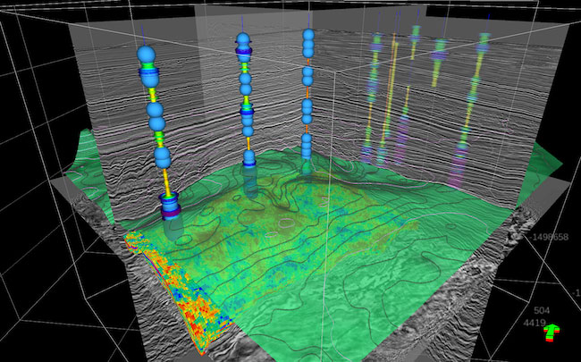
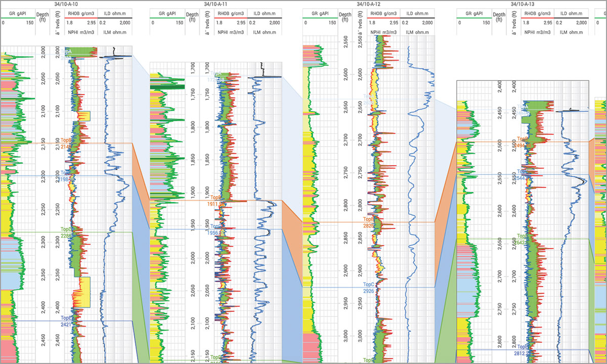
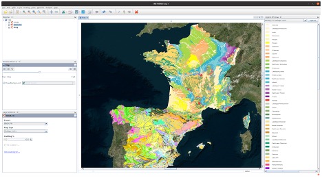
IVAAP™ is a subsurface data visualization platform that offers the ability to search, access, and display 2D/3D data in a single user-friendly dashboard on the web. Using a microservices architecture, IVAAP supports industry data standards, including OSDU, PPDM, WITSML, and several commercial databases. Deployable in any environment (private, cloud, hybrid, on-premise, Docker, etc.), IVAAP can scale to meet the needs of tens to thousands of users. With IVAAP’s architecture and standard APIs, users can create diverse workflows across applications, enabling interoperability between applications and liberating the data access to machine learning.


Microservices Architecture
IP, Science, & Workflow
Powerful Security